Highway: I-40 EB WB
Mile Marker: MM 340.5
City: SANDERS
State: AZ
Phone: 928-688-2741
Parking: There is a Mobil with limited truck parking at exit 333 west of the scales- we have seen trucks park in the east bound scales though we have never parked there more than a few minutes- after the scales, there is a Speedy’s truck stop and a rest area east of the port of entry at exit 359 AZ/NM border.
Parking: There is a Speedy’s truck stop and Rest Area at NM/AZ border exit 359 and Ortega’s Indian Center advertises truck parking at exit 341 east of the Sanders POE. There is a Mobil truck stop at exit 333 west of the truck weigh station- truck parking is in a dirt lot behind the diesel pumps.
Information
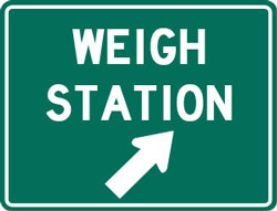
The weigh station uses Pre Pass and also has lighted signs in the roadway so that non-PrePass trucks can also bypass when given the okay. But if you’re thinking about blowing by the scale even if you don’t get an okay to bypass, think again. They have cameras installed on the roadway to catch your license plate number in that event.
There are signs in the roadway leading up to this weigh station that say that all commercial vehicles must weigh, that all vehicles with livestock must weigh and that all commercial vehicles carrying produce plants or seed must weigh. There is an agricultural checkpoint at the Sanders port of entry.
Alternate Route Information
THERE IS A WEIGH STATION ON THIS ROUTE THAT SHOULD CLOSE AT NIGHT. To get around this weigh station you’ll need to drop south on I 25 out of Albuquerque. You’ll go south to the town of Socorro to route 60 west bound (don’t get confused with route 60 east bound which turns off much further north). You’ll take route 60 into Arizona. On the western edge of the town of Springerville there is a Port of Entry- the Springerville POE. This port generally closes at night and on weekends. That is no guarantee that it will be closed, however, so keep your ears open. There is not a whole lot of truck traffic on this route, so you’ll need to start asking early. Out of Springerville you can take state route 77 north out of Showlow back to I 40. Or you can take 60 all the way in to the Phoenix area. Be aware, route 60 cuts through the Salt River Canyon which has steep downhill and uphill grades along with many sharp turns and switchbacks. You may prefer to take route 260 on the west side of Showlow to Payson Arizona. Out of Payson, you can catch route 87 south to the Phoenix area. Both of these routes can be very hazardous in winter weather.
Another route is to take exit 26 in New Mexico for Business 40, E. Gallup. THERE IS A SIGN STATING THAT YOU MUST CROSS THE PORT OF ENTRY, but there is no Port of Entry along this route. You’ll come off the ramp for exit 26 and turn left, heading toward Gallup. You’ll go 2.3 miles to the light at S. Boardman (which is also route 564)- there is a McDonald’s and a Subway on the corner. There is truck parking at the Gilbert Ortega’s Trading Post along Business Route 40 before Boardman. Turn left at the light for S. Boardman and go 3.3 miles to the light at route 602. Turn left onto route 602 south. Take route 602 south 24.6 miles to Zuni route 4. Zuni route 4 is south of mile marker 5 and there are signs saying you are coming up to the junction with Zuni route 4 shortly before the turn off. If you miss the turnoff, it’s okay- route 602 goes all the way down to route 53 and you will turn right. Route 4 is a short cut. Take Zuni route 4 5 miles to the dead end at route 53. Turn right onto route 53 west. You’ll be on route 53 for
18 miles to the border of Arizona- route 53 turns into route 61 at the Arizona border. On route 53 at mile marker 17, there is a paved pull out area on the east bound side of the road way. After you cross into Arizona, you’ll be on route 61 for 14 miles until you come to the dead end at route 191. The Witchwell Tavern is on the right corner. You will turn SOUTH/LEFt on route 191. DO NOT TURN NORTH/RIGHT ON ROUTE 191, as there is a 10 ton weight limit on route 191 just south of the I 40 junction. Take route 191 south for 29.2 miles until it curves into the town of St. John and junctions with route 61. There is a rail road crossing on route 191, but it is a very flat crossing- trucks with low undercarriage clearance should not have a problem. If you are heading back up to I 40, you can take route 180 which turns to the right about 5.2 miles from St. Johns. Or you can continue on route 61 until it junctions with 60 west and take route 60 into Show Low. In Show Low, you can take route 77 north to Holbrook.
Customer Feedback:
I am trying to find out the stats on getting on OW permit for Williams, AZ; truck will be coming from Farmington, NM. May I use a 3 day temp OW permit. Pleasa advise all that is needed....TY


